BaseMap
BaseMap Pro
BaseMap Pro
Couldn't load pickup availability
Land ownership maps, hunt planning, navigation, GPS, wind, weather, and field tools all in one convenient app. Compatible with iOS and Android smartphones, simply download and install the app from the Play Store or App Store on your smartphone.
OFFLINE GPS and TRACKING
• Save maps for offline use without service
• Know exactly where you are in real time even without cellular coverage
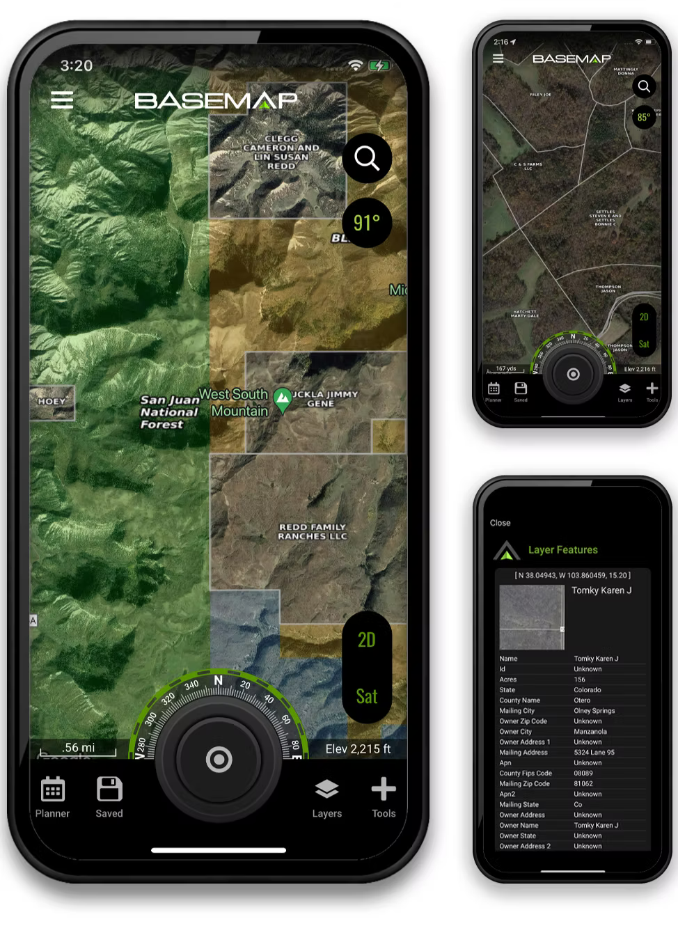
MAP LAYERS
• 900 layers and growing
• Nationwide Color Coded Govt Lands
• Nationwide Private Parcel Boundaries & Owner Names
• Coastal Water Depths & over 4,000 U.S. lakes
• Nationwide Hiking Trails
• Nationwide Wildfires & Timber cuts
• Nationwide Wilderness & Roadless Areas
• State hunting layers (boundaries, WMA’s, habitat, etc)
• Multiple Topography & Satellite Imagery basemap options
• Much more
ARTEMIS AI (Desktop Only)
• Ask questions about state regulations and get detailed answers
• Can provide detailed analysis of hunting tactics for any species
• Analyzes your map to provide a detailed analysis of hunting tactics, stand placement and more
LRF MAPPING (Laser Rangefinder Mapping)
• Use your rangefinder as a powerful mapping tool
• Precisely mark the exact location of distant targets with ANY rangefinder
• Recover game, plan stalks, lookup distant property owners and more, all using your rangefinder
MOBILE GPS
• Know your exact location even without cellular or WiFi service
• See where you are in relation to landmarks, boundaries, roads, trails, etc
• Navigate to trailheads, favorite places, markers, or anything you need to locate with our powerful Search and GoTo features.
XDR (Exact Direction & Range) NAVIGATION TOOL
• Easy Point and Go navigation
• Know the exact distance between you and your destination.
HUNTWIND & WEATHER CENTER
• Wind forecast to better plan your hunt.
• Know the exact day and time to hunt a particular stand and visualize wind direction and scent drift in relation to your location.
• Forecasts, temperature, moon phase, sunrise/sunset, wind, and more.
LOCATION SHARING
• Know exactly where your hunting partner is located
• Real-time updates
OUTDOOR JOURNAL
• Capture, log, and share all your outdoor adventures with the BaseMap community
• Real-time location sharing so friends can see where you are in case of emergency (connection reqd.)
• SmartMarkers - Automatically capture the weather conditions at the time you add a marker.
HARVEST LOG
• Log your hunts as detailed as you'd like. Record your hunt type, species/size, weapon, unit/GMU & much more.
GOOGLE EARTH INTEGRATION
• Export markers and view them right in Google Earth
• View the terrain in true 3D